
Isaias weakens inland after making Florida landfall as Category 2 hurricane
The first Atlantic hurricane of 2026 briefly reached Category 3 strength before striking near Destin, Florida, leaving at least four people dead and hundreds of thousands without electricity.
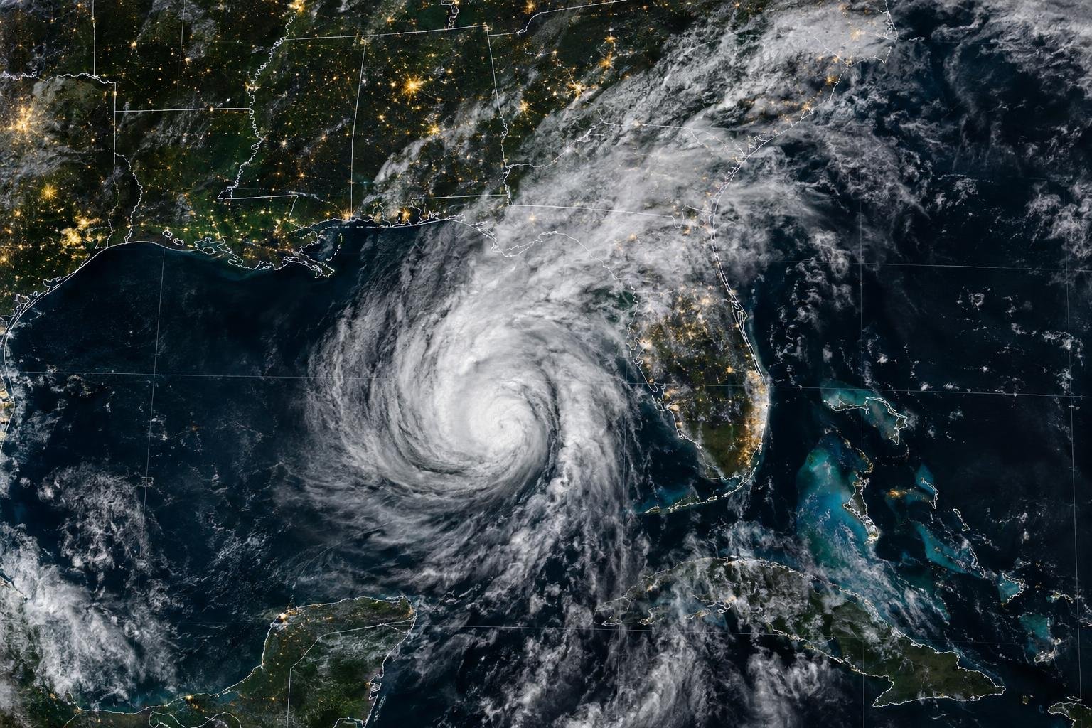
The Big Picture
Hurricane Isaias, the first hurricane of the 2026 Atlantic season, made landfall near Destin, Florida, on Friday evening as a Category 2 storm with maximum sustained winds of 105 mph, according to the National Hurricane Center. The hurricane had briefly strengthened to Category 3 intensity, with winds near 120 mph, before weakening ahead of landfall.
By early Saturday, Isaias had weakened into a post-tropical cyclone while moving across Alabama. Its strongest winds had diminished, but the storm continued to pose serious hazards across the Southeast, including flash flooding, river flooding, downed trees and power lines, and possible tornadoes.
At least four people were reported dead in Florida and Alabama. Officials and news reports linked fatalities to falling trees, while one death in Florida was attributed to carbon monoxide poisoning from a generator operating in an improperly ventilated garage.
What Happened
Isaias formed as Tropical Storm Isaias off eastern Mexico on Oct. 7 after strengthening from Tropical Depression Nine. It became the season's first Atlantic hurricane late that day, ending an unusually long wait for a hurricane during a season that officially began June 1.
The hurricane strengthened rapidly as it moved north through the Gulf of Mexico. By Friday, it had reached Category 3 status, a major hurricane designation, before approaching the Florida Panhandle. It came ashore near Destin at about 8:30 p.m. local time Friday as a Category 2 hurricane, NBC News and other outlets reported.
The storm brought fierce winds and heavy rain to the Florida Panhandle and southern Alabama. Roads flooded in Destin, while authorities in Pensacola warned residents to avoid streets obstructed by debris, fallen trees and power lines. Flights were disrupted at several Panhandle airports before and during the storm.
Power outages mounted quickly. More than 800,000 customers in Florida, Alabama and Georgia were without electricity at points on Saturday, according to reports citing PowerOutage.us. The total changed as utilities restored service and new outages were reported.
Why It Matters
Although Isaias lost hurricane strength soon after landfall, its risks did not end at the coastline. The National Hurricane Center warned that the system could produce 4 to 8 inches of rain across southern Alabama, the Florida Panhandle, the Big Bend region and southwest Georgia. Isolated areas could receive as much as 15 inches.
That rainfall raised the possibility of flash, urban and river flooding, particularly where rain bands persisted. Tornado risks also remained across parts of the eastern Florida Panhandle, Georgia and the Carolinas as the storm moved northeastward.
The storm also interrupted Gulf of Mexico energy operations. Offshore producers temporarily halted about 63% of regional oil production, or nearly 1.3 million barrels per day, and evacuated 121 of the Gulf's 371 staffed platforms, according to figures cited by NPR and other outlets.
Background
The 2026 Atlantic season had been unusually quiet before Isaias. Multiple outlets attributed the limited development largely to a strong El Niño, which can increase wind shear over the Atlantic and hinder tropical systems from organizing.
Isaias was among the latest first hurricanes on record for an Atlantic season, though reports differed over whether its formation tied, nearly tied or fell just short of the 1905 benchmark. What is undisputed is that none of the season's earlier named storms had strengthened beyond tropical-storm status.
Florida, Alabama and Georgia declared states of emergency before landfall, and mandatory evacuation orders were issued in some coastal communities. Those measures allowed officials to mobilize emergency resources ahead of the storm's arrival.
What Happens Next
Isaias is forecast to continue weakening as it moves inland, but officials have urged residents to remain alert to flooding, unstable trees, hazardous roads and tornado warnings. The greatest immediate concern has shifted from coastal hurricane conditions to inland rainfall and flooding across portions of the Southeast and southern Appalachians.
Authorities have also warned residents using generators to keep them outdoors and away from enclosed spaces, after the reported carbon monoxide death in Florida. Cleanup and power restoration efforts are expected to continue as crews assess damage across the hardest-hit communities.
The world's most important stories. Explained clearly. Delivered daily.
- Every morning
- Five-minute read
- Unsubscribe anytime